
I have lived in the southern edge of California, but the Central Valley keeps coming on my head. It has remained as a place of wonder in my heart too.
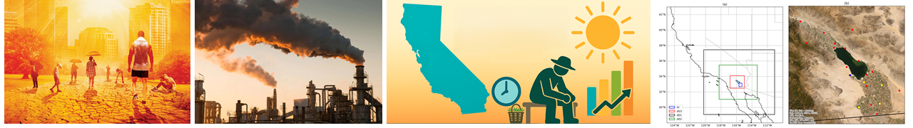
Anything that is at the center has power, it pulls you towards it. Central Valley is California’s center. It is California’s womb. Womb is where creation takes place. It is where growth takes place. No wonder, Central Valley produces more than 2/3 of the fruits and nuts consumed in the entire US.
When you truly wish for something, the entire universe conspires to make it happen.
I got invited to Sacramento for an event at the California State Capitol. I took this opportunity to steer through the fertile lands of the Central Valley. But something got my plan changed. I blamed the weather. And I decided to fly to Sacramento, instead of driving. I now planned to drive back, through the Central Valley.
The stormy weather this season lasted almost a week in the first week of February 2024 due to multiple atmospheric rivers. The flight took off on time despite the bad weather. Clouds were beautiful on their own but that is not what I had wished to see. Sierra Nevada mountains were fully covered with snow too. That was still not what I had wished to see. I had wished to see the green agricultural fields of the Central Valley from above. I couldn’t see much. Only a part of the green fields was visible near Sacramento, as the plane descended for landing. Those too, were flooded due to the heavy rain.


I atteded a CCST event at the California State Capitol in the afternoon the same day. It was a pleasure presenting my current research in the Imperial Valley to the Assemblymembers Mike Fong and Christopher Ward. There were othere legislative staff, people from California Energy Commission, California Air Resources Board, and also a astrophysics group from University of California (UC), Santa Cruz attending the event. It was specially enlightening to chat with professor Sandra Faber, an astrophysicst at UC, Santa Cruz, who had interesting views on a range of topics from energy and environment to policies. It was quite an experience presenting my research, repeatedly, in an elevator-pitch style, to multiple people from different backgrounds, packed in a small meeting room at the Capitol.
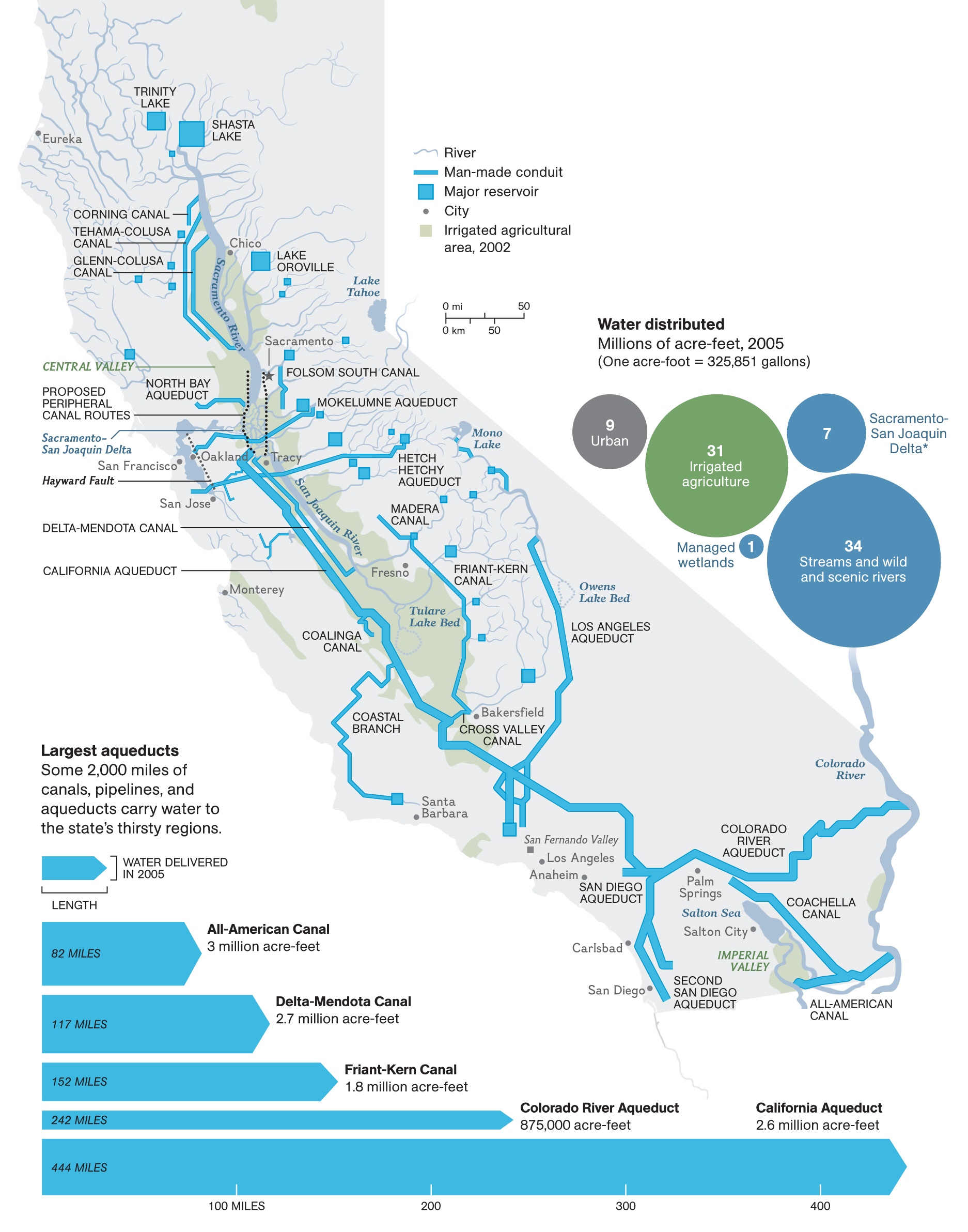
My return trip started from Oroville. Central valley can’t be understood without looking at its water infrastructures. That is why I decided to start my journey from the Oroville dam, the tallest dam in the US, on the Feather River, north of Sacramento. The dam was built between 1957-1968. To highlight the significance of this project to the entire California, a sackful of gravel and sand was used in the first concrete used in this dam.


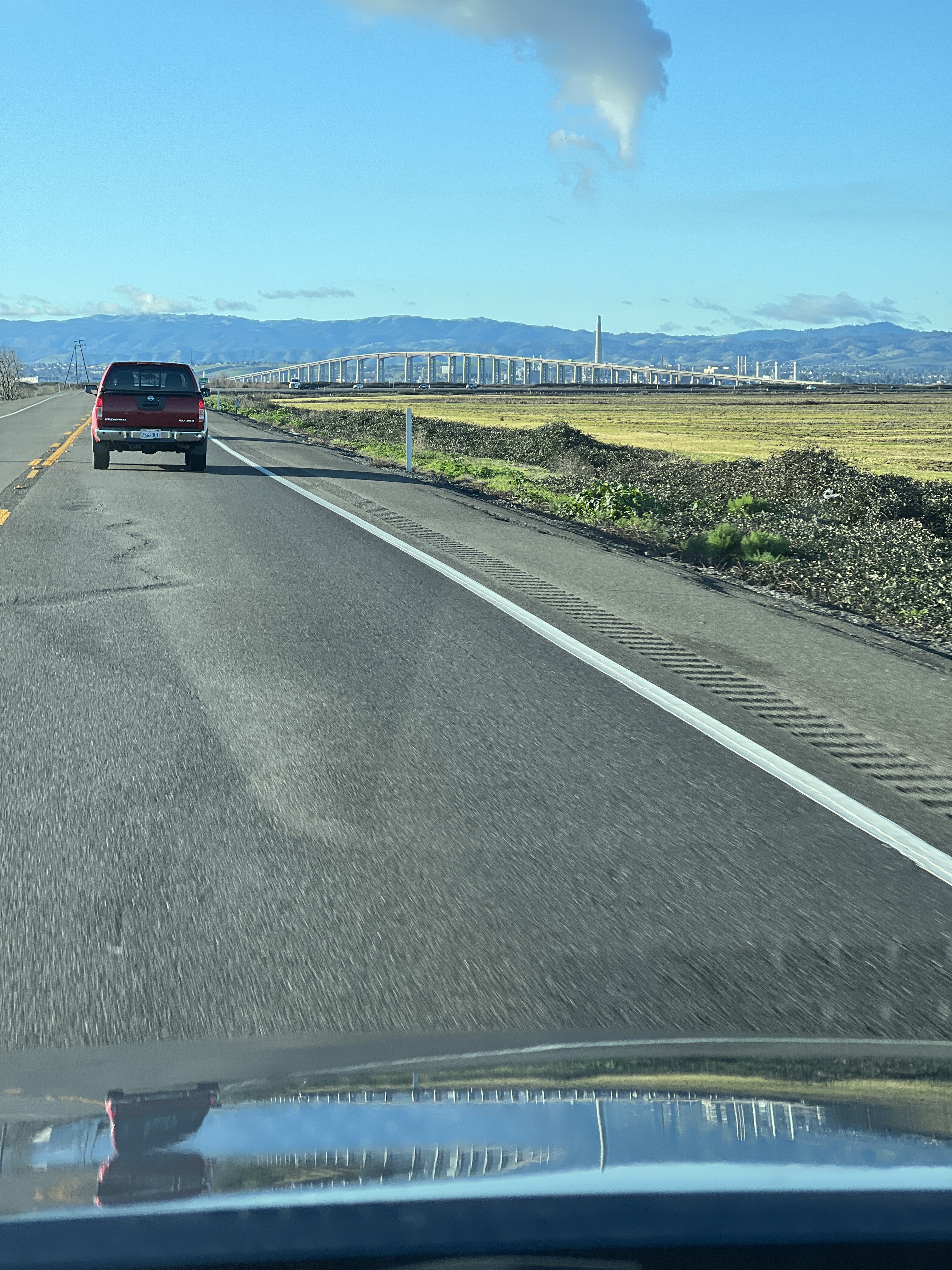
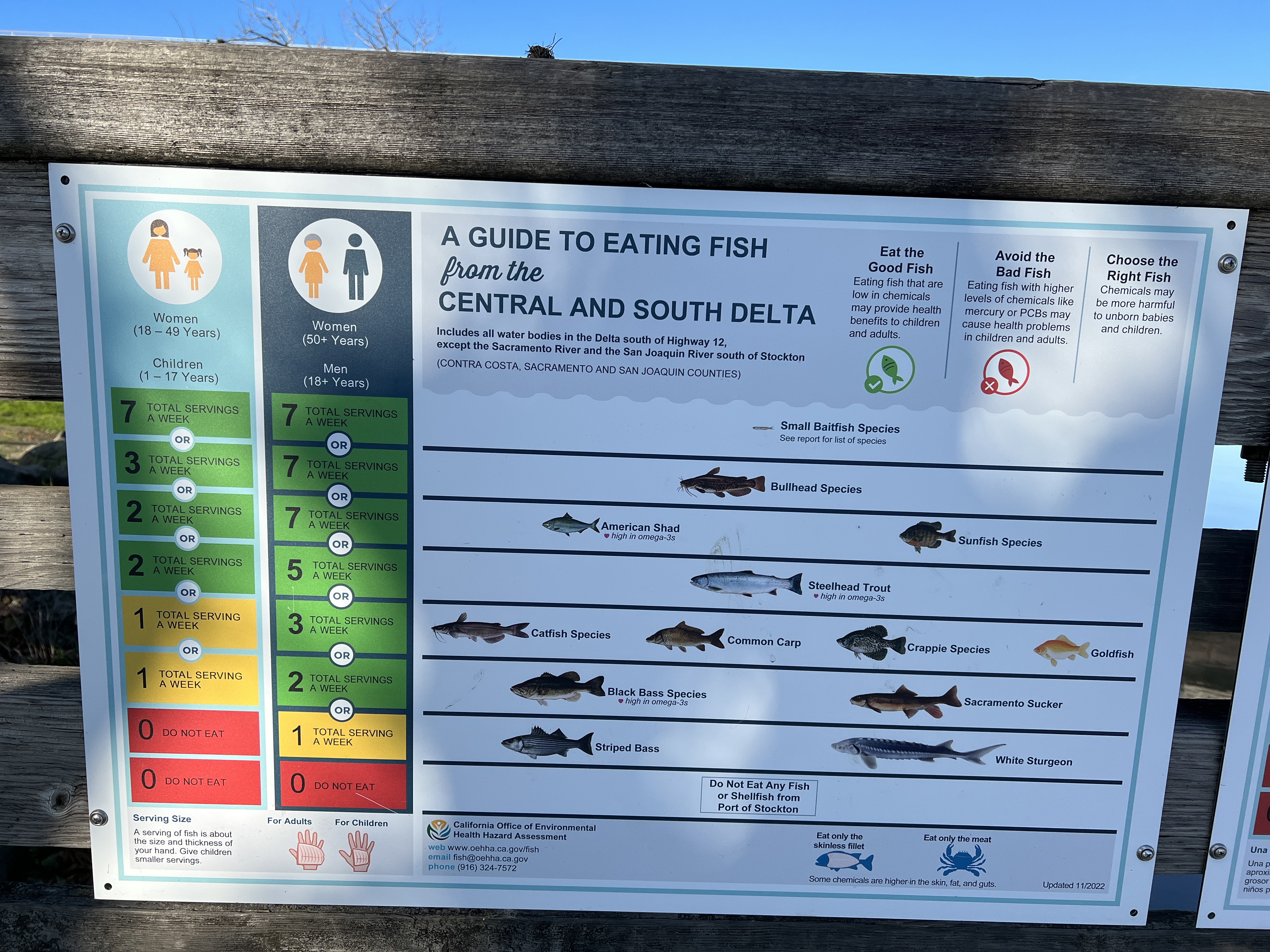
My first stop was at the Antioch Bridge that lies in the south of the Sacramento County. This is the place where the northward flowing San Joaquin river meets the southward flowing Sacramento river. Such places are considered auspicious — they are, indeed. A short video clip of the area that I took is here. As I stood on the fishing pier, a useful guide to fish eating captured my attention (included below).
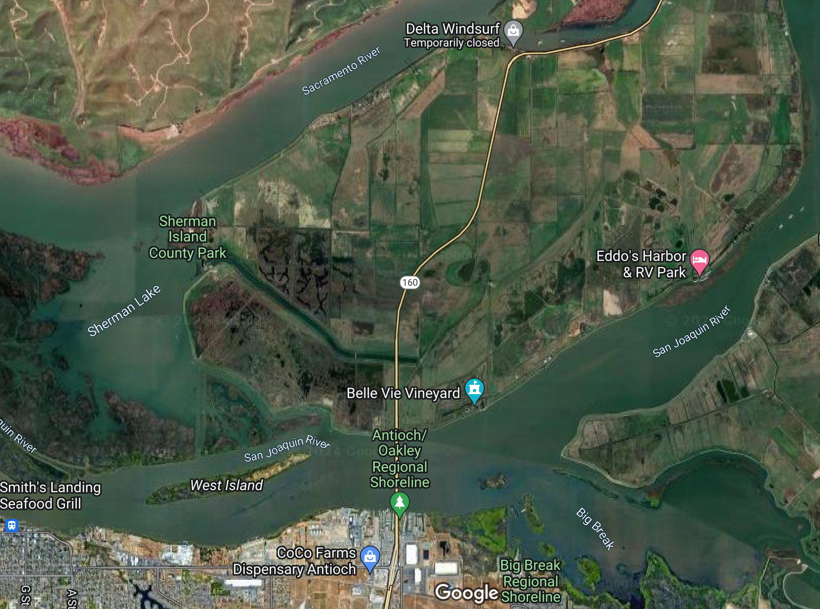
After seeing the Antioch Bridge area, I headed south through the Byron highway. I stopped near the UC Davis Fish conservation center to see the beginning part of the California Aqueduct in the Sacramento-San Joaquin river delta, which was built to supply water from the northern California to the southern California. This was an engineering masterpiece because it involves pumping of water against gravity by huge pumps and dumping the water to the distribution aqueducts and canals. At the moment, these canals and aqueducts never run to their full capacity because the federal and state regulations now restrict pumping of water from the delta region to protect the endangered delta-smelt and other local fish species.
The green meadows on the little hills seen in the west of the Byron highway were spectacular. The view definitely reminded me of the natural beauty of Switzerland. The US as a country is huge and it indeed has so many beautiful landscapes waiting for us to explore.
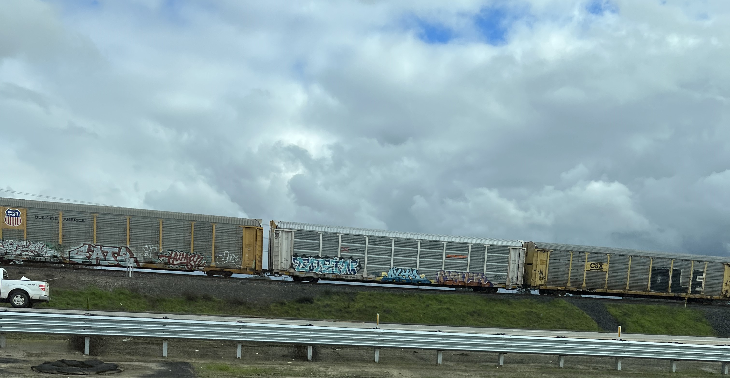
I intentionally took California highway 99 avoiding the more usual I-5 route, although it would take much longer time to reach San Diego. As I drove through the Central Valley cities of Modesto, Merced, Fresno, and Tulare, I saw several railway lines that ran through the cropfields. Most of them were part of the Union Pacific railroad, which is the second largest railroad in the US. This centuries-old railroad network which was first built in 1806 made it possible to transport the excess produce of the Central Valley to the rest of the US. There are probably other smaller trolleys as well operated by the individual farm owners in the central valley.
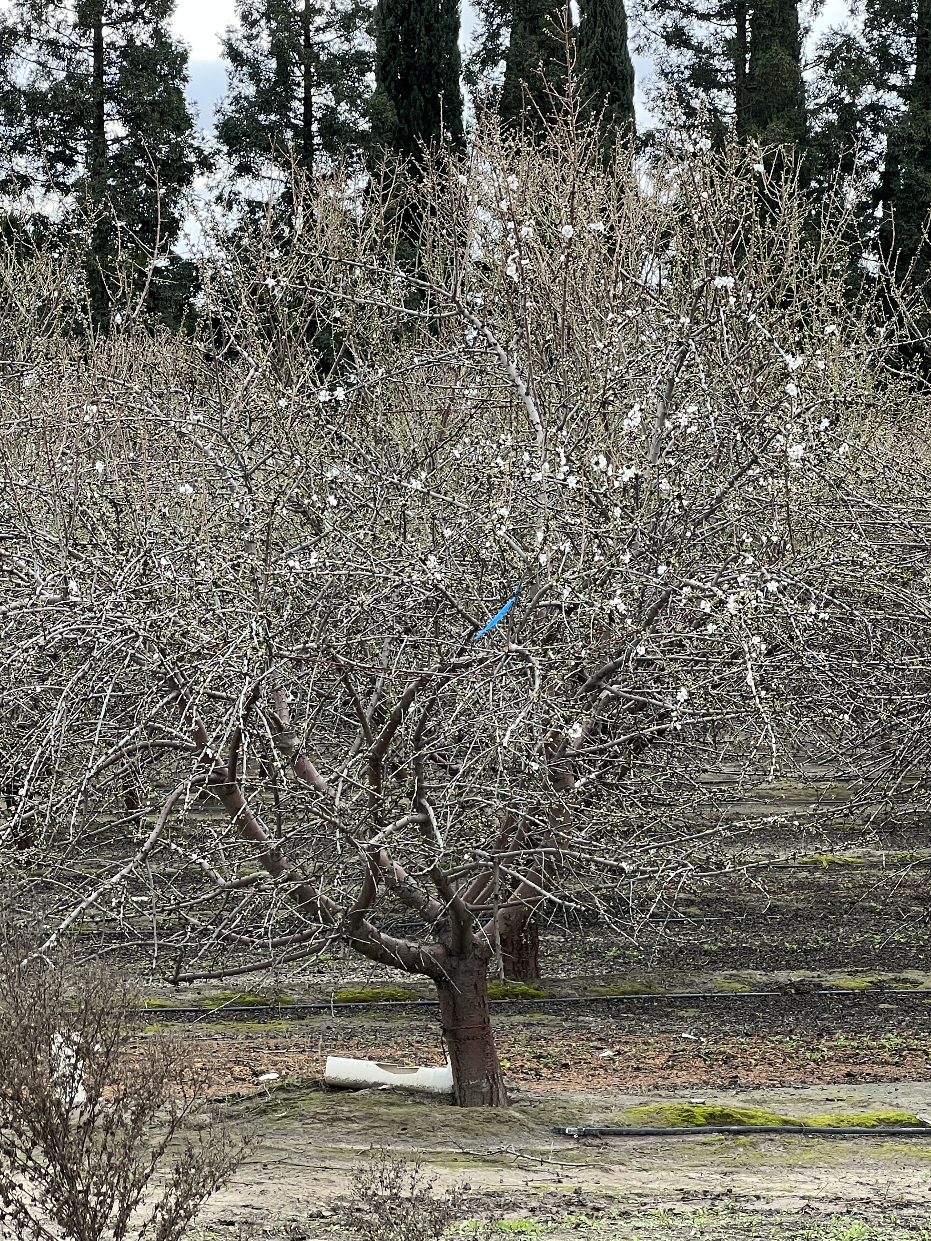
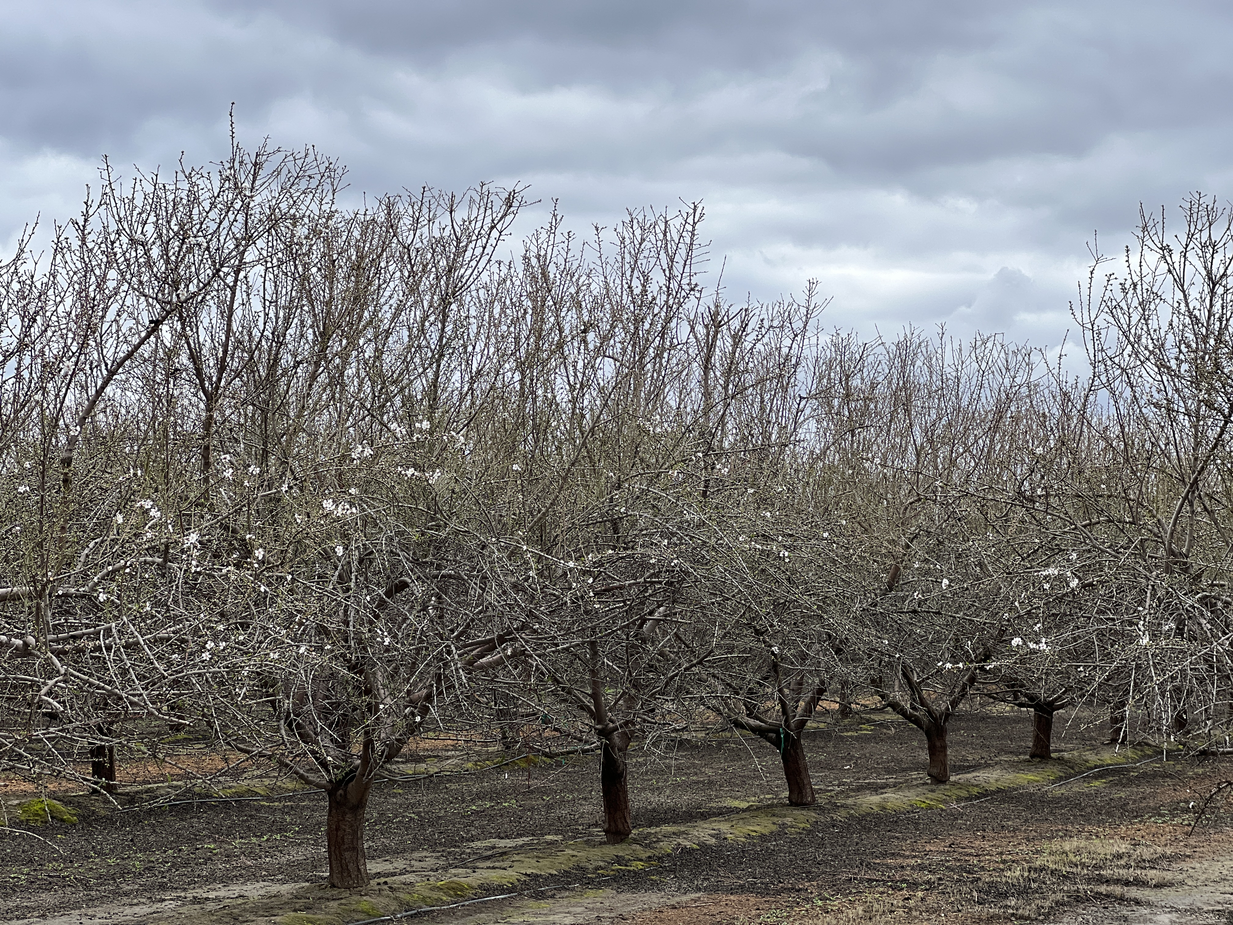
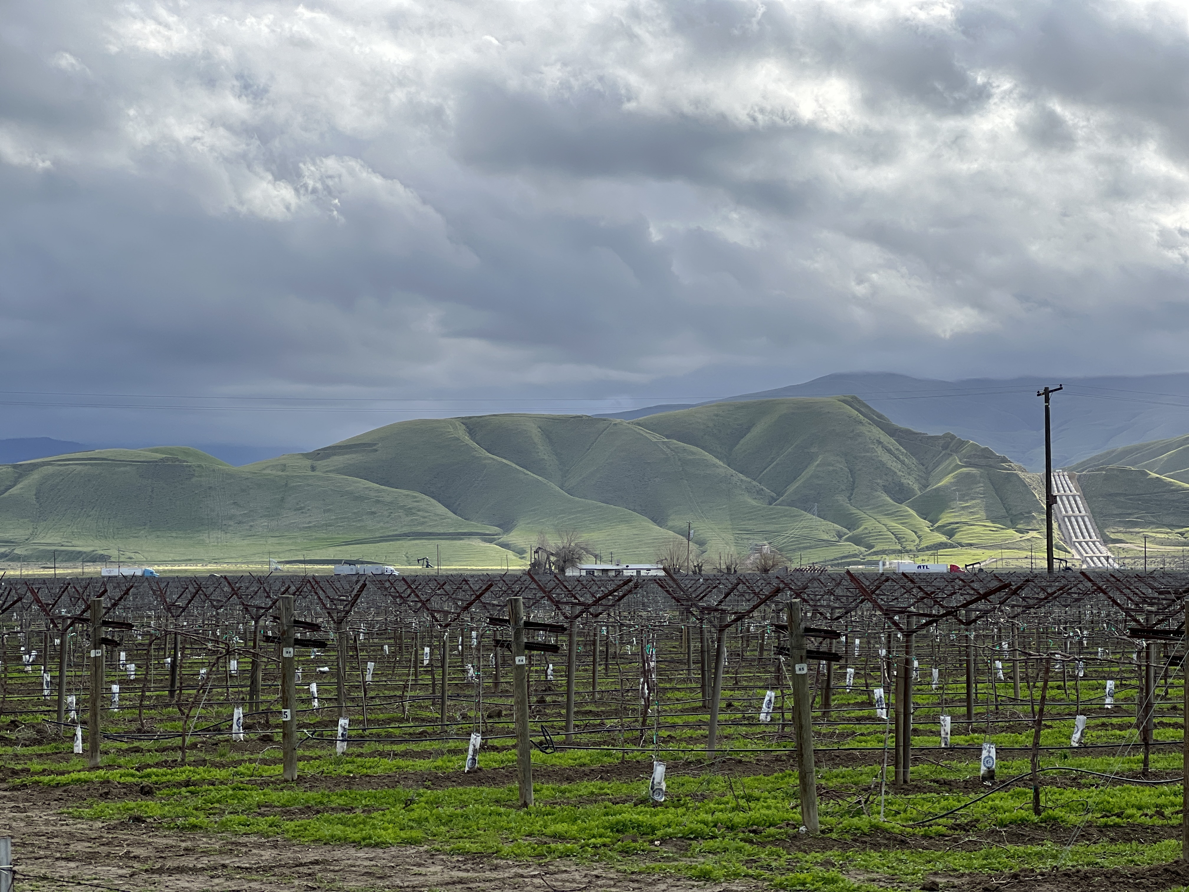
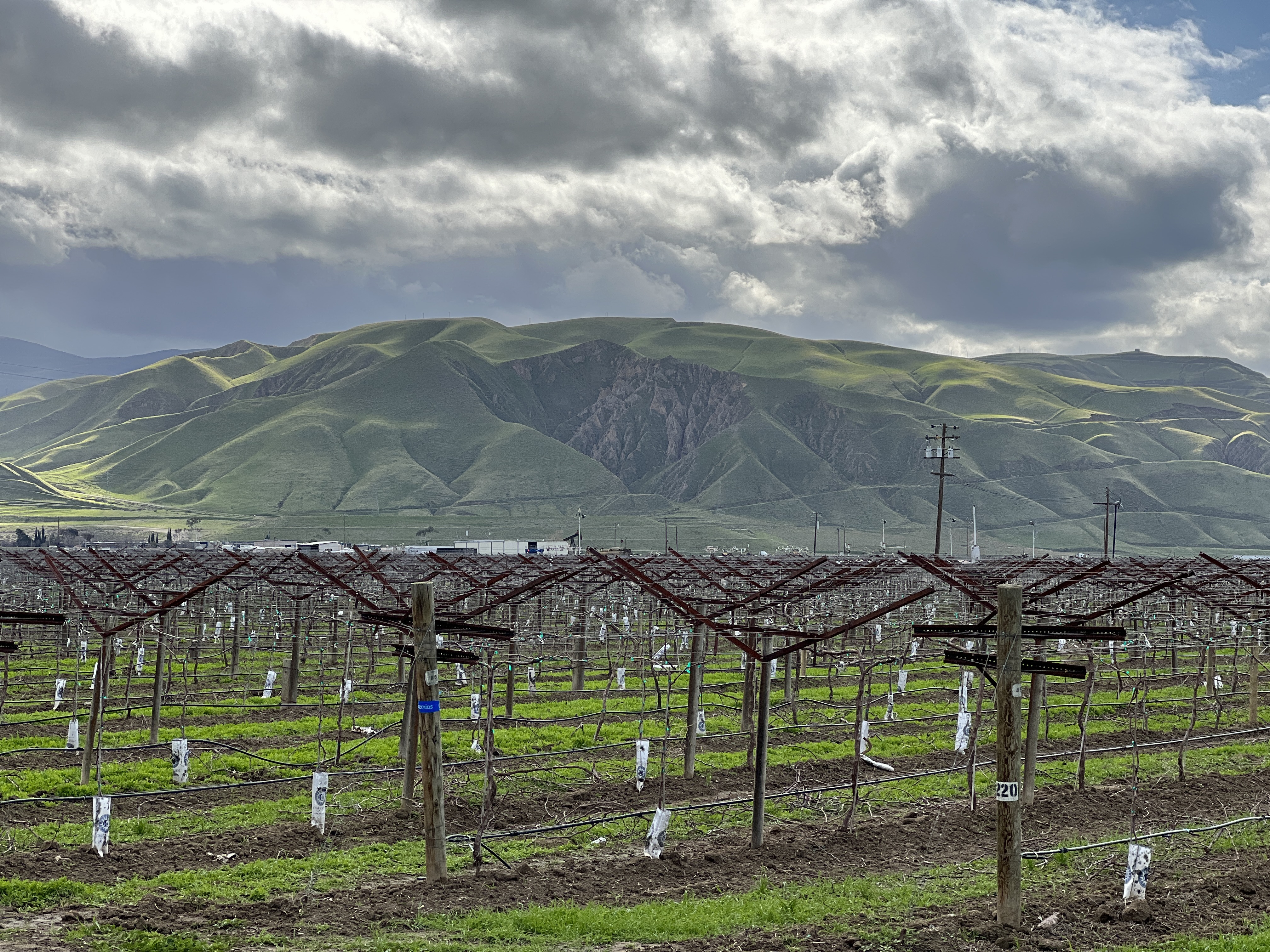
There were crop fields on both sides of the highway. I drove for hours through these fields while stopping occasionally to take some pictures. The almond trees were just beginning to flower. I couldn’t really tell whether they were amond trees or peach (apricot?) trees because I know that both of them look similar. We had a lot of peach trees in our village so I can recognize them. But it is hard to tell what it is in this flowering season.
At the end of the crop fields near Bakersfield, the green medows looked spactacular on the west side of highway 99. I also saw a huge water pumping station (visible in the picture below). It was State Water Project’s Wind Gap pumping plant, the last major water lift from the California Aqueduct over the Tehachapi Mountains, which was renamed the Ira J. Chrisman Wind Gap Pumping Plant in his honor.
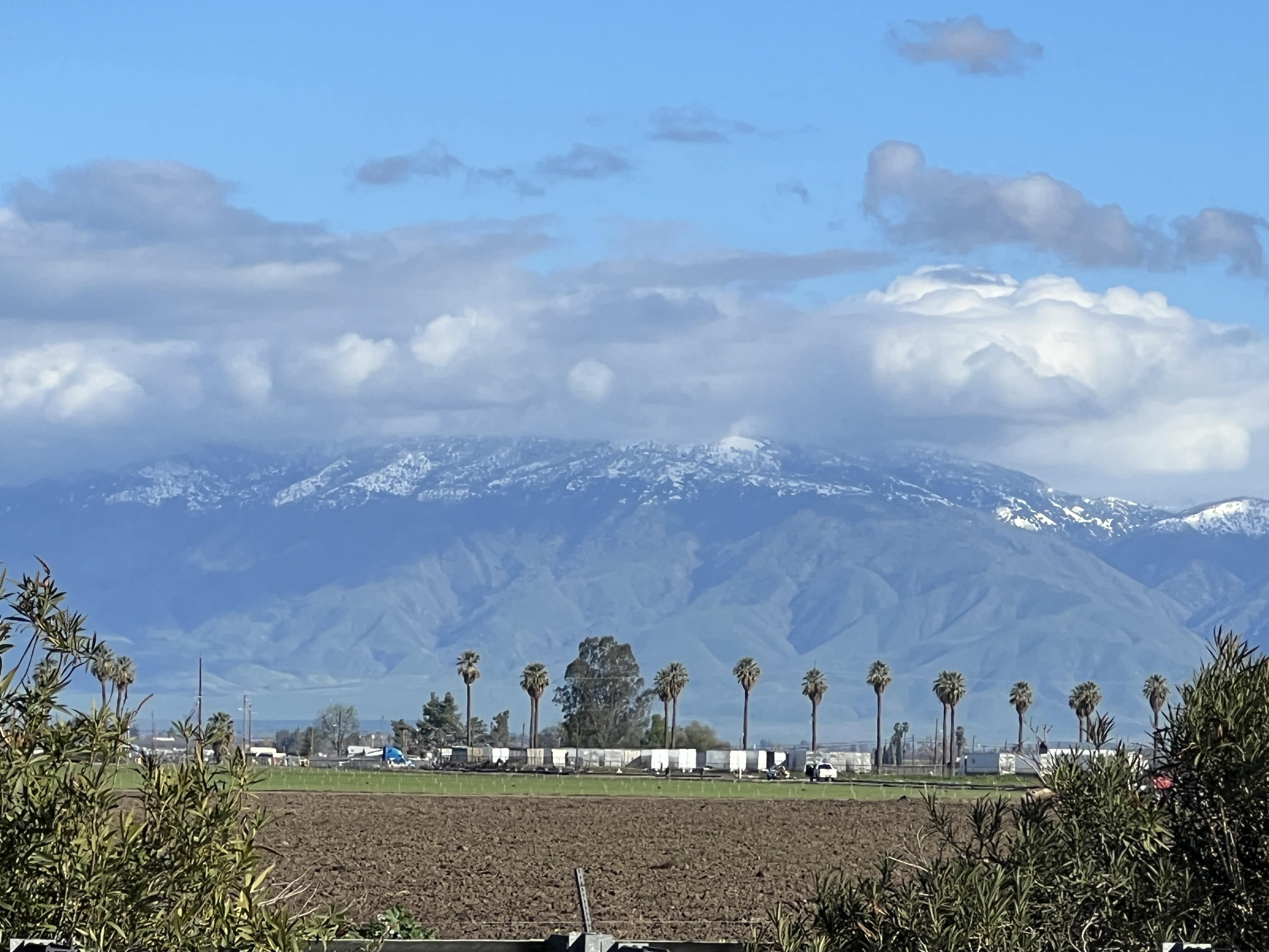
When I looked on the left, the Sierra Nevada mountain was smiling with considerable amount of snow.
The history of California is so intriguing. The Central Valley was transformed from desert to a rich land producing fruits, nuts, and vegetables some 100 years ago. Engineers built one of the most complex network of Aqueducts to irrigate the Central Valley farmlands. Dams were built, canals were laid, wells were digged. The California Aqueduct that begins at the Sacramento–San Joaquin River Delta was built in 1963. That is well before our era of computer and internet. We are living in the 21st century, but infrastructure-wise, we are only enjoying what our ancestors built. We haven’t built anything such significant in our times. Of course we have done a lot in the IT and computing sector.
The older generation got busy working. They got busy building and growing. They developed and used technologies that defied even the worst droughts. They adapted. They adapted from one crop to another. From rivers to wells. From west to east.
Central Valley farmers used technology as it became available to foster their yields. They knew all the details, when to plant, how to plant, and even how to better pollinate. To them, it didn’t matter, whether water was available or not. It didn’t matter whether soil was good or not. They grew pistachios when the water was saline. When winds didn’t blow, they knew how to pollinate. They knew how to make the fruits puffy too.
I am ever fascinated by its story of transformation. California is a miracle. Not a single person made it. But it has only known growth from the very beginning. It has never remained. And will never stand still.
Many things in California happened more than 200 years ago. California developed, flourished, and a part of it even got perished much before we were even born. California has always been in a rush, from gold rush, to water rush, to now lithium rush.
California still looks beautiful as it moves, and transforms. It is wonderful to live here and be a witness of California’s growth. California is indeed unbeatable.
Leave a Reply