
Parajuli and Zender (2017) developed two high-resolution (500-m) global dust source maps to enhance dust emission representation in widely used weather and climate models such as WRF-Chem and CESM.
The first one is a Land Surface Map (LSM) produced using a supervised machine learning approach (maximum likelihood method) applied to the MODIS Blue Marble imagery. The LSM depicts the spatial distribution of landforms in dust source regions, aiding in the delineation of distinct dust source boundaries within dust models.
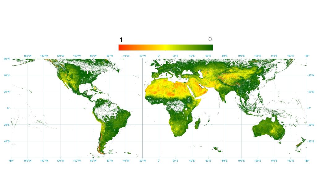
The second one is a Sediment Supply Map (SSM) created by integrating upstream drainage area data with blue-band reflectance from the same MODIS Blue Marble RGB dataset. The SSM can serve as a substitute for the “erodibility” parameter in WRF-Chem and CESM dust emission schemes.
The original sediment supply map (SSM) and the land surface map (LSM) at ~500m resolution both can be downloaded in ArcGIS raster format from the following Google Drive link:
https://drive.google.com/file/d/1AY1cgpqBfCULohcRdRGBrLuj677Hg0Yh/view?usp=sharing
Sediment Supply Map (SSM)
The sediment supply map (SSM) in NetCDF format can be downloaded from the following link:
https://drive.google.com/file/d/1AmQjJdSNC1Z4z7cSig5UJnp4aSJrQbWE/view?usp=sharing
Land Surface Map (LSM)
The land surface map (LSM) in NetCDF format can be downloaded from here:
https://drive.google.com/file/d/1AqpTqr3AI1wvcLMwhSzrFS4KJrp762U8/view?usp=sharing
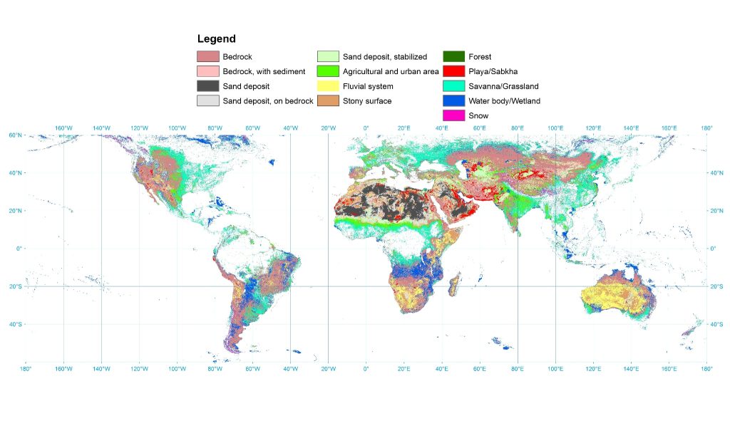
The indexing in LSM NetCDF file follows the Figure 2 legend in the original paper:
1. Bedrock
2. Bedrock with sediment
3. Sand deposit
4. Sand deposit on bedrock
5. Sand deposit, stabilized
6. Agricultural and urban area
7. Fluvial system
8. Stony surface
9. Forest
10. Playa/Sabkha
11. Savanna/Grassland
12. Water body/Wetland
13. Snow