
California is not just about Silicon Valley; it is the Central Valley and the Imperial Valley (IV) that truly define California’s richness, as they produce more than half of the fruits, vegetables, and nuts consumed in the United States. The Imperial Valley, which lies on the south side of the Salton Sea, alone provides more than 80% of the nation’s fresh winter fruits and vegetables. But have you ever wondered how those succulent oranges, almonds, and lettuces come to your table every day?
Unfortunately, the farmworkers in the Imperial and Coachella Valleys experience a high number of cardiovascular diseases due to heat stress. Not only this, the IV region is recently going through tremendous environmental stress due to water and air pollution; extreme droughts and flooding; and land use change.
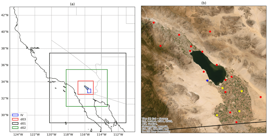
I have built a high-resolution, high-performance weather model set up centered around the Imperial and Coachella Valleys that can be used to address such environmental concerns. As an example, the model can simulate how the microclimate will change when croplands are converted to solar fields. Similarly, the model can be used to forecast of heat stress experienced by farm workers at a specific time and location using Wet Bulb Globe Temperature (WBGT).
What question intrigues you the most about this region?
Leave a Reply